


La forêt de Chaux

viam19
User

Length
12.8 km

Max alt
681 m

Uphill gradient
330 m
Km-Effort
17.2 km

Min alt
482 m

Downhill gradient
330 m
Boucle
Yes
Creation date :
2022-04-10 07:54:14.043
Updated on :
2022-04-10 13:10:38.934
5h08
Difficulty : Easy

FREE GPS app for hiking
 SityTrail
IGN / Geographical institutes
SityTrail Plus
The world is yours!
About
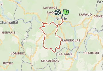
Trail Walking of 12.8 km to be discovered at New Aquitaine, Haute-Vienne, Nedde. This trail is proposed by viam19.
Photos


Positioning
Country:
France
Region :
New Aquitaine
Department/Province :
Haute-Vienne
Municipality :
Nedde
Location:
Unknown
Start:(Dec)
Start:(UTM)
409122 ; 5063521 (31T) N.
Comments