


#1 De Falaise à St Martin

yannick-p
User

Length
4.7 km

Max alt
204 m

Uphill gradient
33 m
Km-Effort
5.2 km

Min alt
173 m

Downhill gradient
33 m
Boucle
Yes
Creation date :
2022-04-10 17:07:32.698
Updated on :
2022-04-10 17:16:10.71
1h10
Difficulty : Easy
21m
Difficulty : Easy
3h00
Difficulty : Very easy

FREE GPS app for hiking
 SityTrail
IGN / Geographical institutes
SityTrail Plus
The world is yours!
About
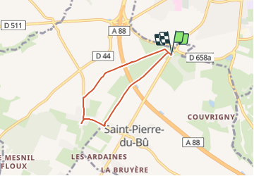
Trail Walking of 4.7 km to be discovered at Normandy, Calvados, Saint-Pierre-du-Bû. This trail is proposed by yannick-p.
Description
Petite rando sur les traces de la boucle géocachnig de pikluc1315 :
https://www.geocaching.com/geocache/GC9QEX9
Positioning
Country:
France
Region :
Normandy
Department/Province :
Calvados
Municipality :
Saint-Pierre-du-Bû
Location:
Unknown
Start:(Dec)
Start:(UTM)
704695 ; 5418031 (30U) N.
Comments