


en suivant le Coinon

Djaie60
User

Length
8.3 km

Max alt
94 m

Uphill gradient
86 m
Km-Effort
9.4 km

Min alt
34 m

Downhill gradient
86 m
Boucle
Yes
Creation date :
2022-04-11 07:34:14.327
Updated on :
2022-04-11 07:36:23.945
2h08
Difficulty : Medium

FREE GPS app for hiking
 SityTrail
IGN / Geographical institutes
SityTrail Plus
The world is yours!
About
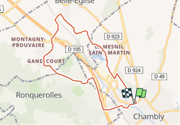
Trail Walking of 8.3 km to be discovered at Hauts-de-France, Oise, Chambly. This trail is proposed by Djaie60.
Positioning
Country:
France
Region :
Hauts-de-France
Department/Province :
Oise
Municipality :
Chambly
Location:
Unknown
Start:(Dec)
Start:(UTM)
444568 ; 5446521 (31U) N.
Comments