


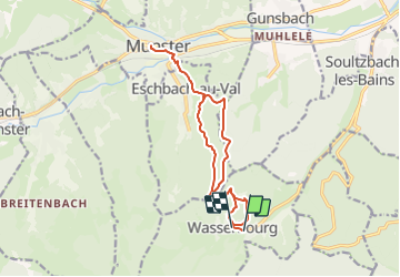
Wasserbourg-Munster A/R

nicolas54230
User

Length
14.2 km

Max alt
842 m

Uphill gradient
799 m
Km-Effort
25 km

Min alt
371 m

Downhill gradient
783 m
Boucle
No
Creation date :
2022-04-11 11:38:23.977
Updated on :
2022-04-11 11:39:38.261
5h38
Difficulty : Very difficult

FREE GPS app for hiking
 SityTrail
IGN / Geographical institutes
SityTrail Plus
The world is yours!
About
Trail Walking of 14.2 km to be discovered at Grand Est, Haut-Rhin, Wasserbourg. This trail is proposed by nicolas54230.
Positioning
Country:
France
Region :
Grand Est
Department/Province :
Haut-Rhin
Municipality :
Wasserbourg
Location:
Unknown
Start:(Dec)
Start:(UTM)
363018 ; 5318192 (32U) N.
Comments