Trail Walking Castelnau-Barbarens - castelnau - Barbarens - Photo

castelnau - Barbarens

© OpenStreetMap contributors
Length
Length
10.6 km
Max alt
Max alt
281 m
Uphill gradient
Uphill gradient
224 m
Km-Effort
Km-Effort  
13.5 km
Min alt
Min alt
169 m
Downhill gradient
Downhill gradient
226 m
Boucle
Boucle
Yes
Creation date :
2022-04-12 07:28:36.973
Updated on :
2022-04-12 10:05:20.16

(0 Reviews)

Walking
Walking
2h34
Difficulty : Easy

Scan this QR Code to open this trail in the SityTrail application

FREE GPS app for hiking

Logo SityTrail SityTrail

IGN / Geographical institutes

Download SityTrail from the App Store Download SityTrail from Google Play

Logo SityTrail SityTrail World

The world is yours!

Download SityTrail from the App Store Download SityTrail from Google Play Download SityTrail on Huawei AppGallery

About

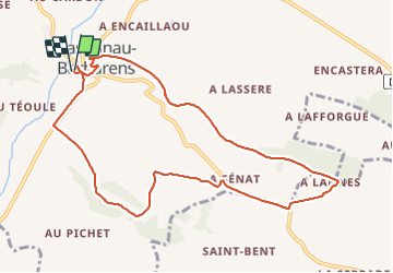
Trail Walking of 10.6 km to be discovered at Occitania, Gers, Castelnau-Barbarens. This trail is proposed by christian19.

Description

Beau village à visiter puis rando tranquille.

Elevation profile

Positioning

Country:
France
Region :
Occitania
Department/Province :
Gers
Municipality :
Castelnau-Barbarens
Location:
Unknown
Start:(UTM)
315992 ; 4827125 (31T) N.

Trails nearby

Trail Walking Boulaur - Un tour à Boulaur par Saramon - Photo
Walking
tracegps

Walking

Medium
(2)
Boulaur, Occitania, Gers, France
14.9 km | 18.3 km-effort
5h 10min
Yes
Trail Walking Boulaur - Le chemin des Pèlerins a Boulaur - Photo
Walking
Fafou64

Walking

Very easy
Boulaur, Occitania, Gers, France
8.9 km | 11.4 km-effort
2h 4min
Yes


Close
My subscriptions