Boucle de Olne 13 Km

Efr
User
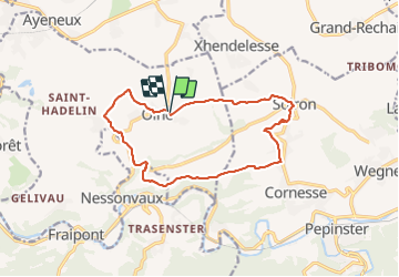

Length
12.6 km

Max alt
283 m

Uphill gradient
278 m
Km-Effort
16.3 km

Min alt
123 m

Downhill gradient
279 m
Boucle
Yes
Creation date :
2022-04-12 08:51:21.0
Updated on :
2022-04-12 14:46:35.019
3h33
Difficulty : Unknown

FREE GPS app for hiking
 SityTrail
IGN / Geographical institutes
SityTrail Plus
The world is yours!
About
Trail Walking of 12.6 km to be discovered at Wallonia, Liège, Olne. This trail is proposed by Efr.
Description
Depart parking terrain de foot Olne
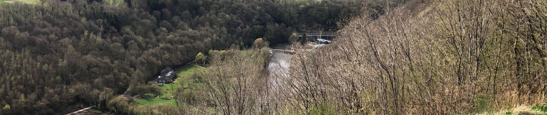
Photos


Positioning
Country:
Belgium
Region :
Wallonia
Department/Province :
Liège
Municipality :
Olne
Location:
Unknown
Start:(Dec)
Start:(UTM)
694777 ; 5607896 (31U) N.
Comments