


orge moulin

canal
User

Length
14.9 km

Max alt
59 m

Uphill gradient
135 m
Km-Effort
16.7 km

Min alt
36 m

Downhill gradient
130 m
Boucle
No
Creation date :
2022-04-14 07:29:19.622
Updated on :
2022-04-14 12:28:04.159
4h58
Difficulty : Difficult

FREE GPS app for hiking
 SityTrail
IGN / Geographical institutes
SityTrail Plus
The world is yours!
About
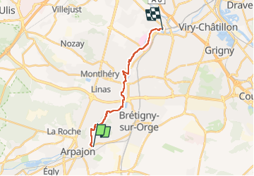
Trail Walking of 14.9 km to be discovered at Ile-de-France, Essonne, Saint-Germain-lès-Arpajon. This trail is proposed by canal.
Description
entre orge et boelle
Positioning
Country:
France
Region :
Ile-de-France
Department/Province :
Essonne
Municipality :
Saint-Germain-lès-Arpajon
Location:
Unknown
Start:(Dec)
Start:(UTM)
445664 ; 5382519 (31U) N.
Comments