


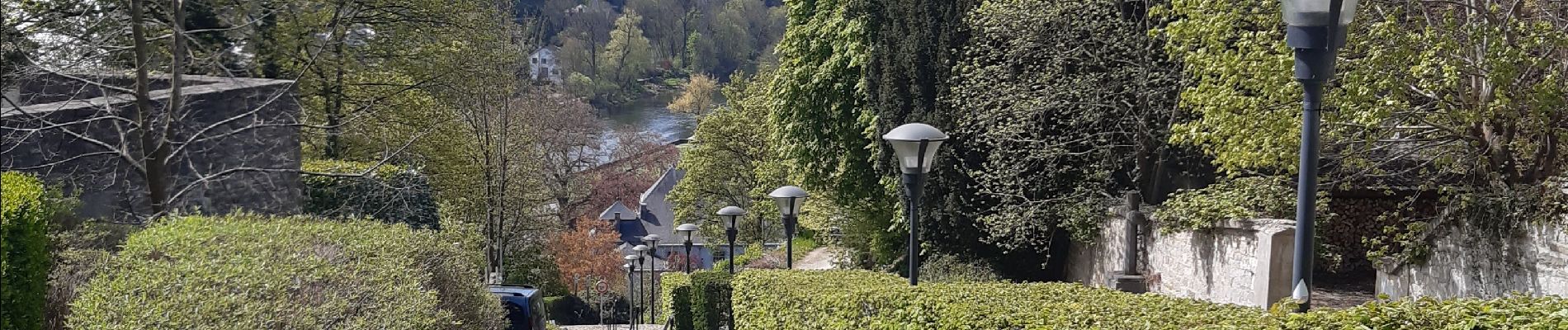
esneux . evieux . fontain. la motte . avionpuits . esneux

stef789
User GUIDE
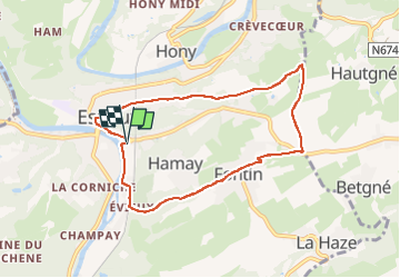

Length
7 km

Max alt
230 m

Uphill gradient
159 m
Km-Effort
9.1 km

Min alt
85 m

Downhill gradient
157 m
Boucle
Yes
Creation date :
2022-04-20 10:17:10.424
Updated on :
2022-04-20 12:13:00.18
1h54
Difficulty : Easy

FREE GPS app for hiking
 SityTrail
IGN / Geographical institutes
SityTrail Plus
The world is yours!
About
Trail Walking of 7 km to be discovered at Wallonia, Liège, Esneux. This trail is proposed by stef789.
Photos


Positioning
Country:
Belgium
Region :
Wallonia
Department/Province :
Liège
Municipality :
Esneux
Location:
Esneux
Start:(Dec)
Start:(UTM)
682253 ; 5600812 (31U) N.
Comments