


ballancourt

gdela
User
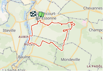

Length
16.9 km

Max alt
151 m

Uphill gradient
283 m
Km-Effort
21 km

Min alt
49 m

Downhill gradient
290 m
Boucle
Yes
Creation date :
2022-04-21 07:34:19.69
Updated on :
2022-04-21 12:57:47.169
3h58
Difficulty : Medium

FREE GPS app for hiking
 SityTrail
IGN / Geographical institutes
SityTrail Plus
The world is yours!
About
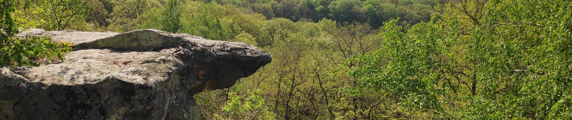
Trail Walking of 16.9 km to be discovered at Ile-de-France, Essonne, Ballancourt-sur-Essonne. This trail is proposed by gdela.
Photos


Positioning
Country:
France
Region :
Ile-de-France
Department/Province :
Essonne
Municipality :
Ballancourt-sur-Essonne
Location:
Unknown
Start:(Dec)
Start:(UTM)
453892 ; 5374524 (31U) N.
Comments