


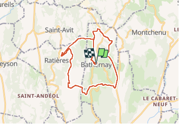
Bathernay , Tour de Ratière

alinetpierre
User

Length
17.9 km

Max alt
465 m

Uphill gradient
468 m
Km-Effort
24 km

Min alt
269 m

Downhill gradient
467 m
Boucle
Yes
Creation date :
2022-04-22 07:04:24.0
Updated on :
2022-04-22 12:16:06.76
3h55
Difficulty : Easy

FREE GPS app for hiking
 SityTrail
IGN / Geographical institutes
SityTrail Plus
The world is yours!
About
Trail Walking of 17.9 km to be discovered at Auvergne-Rhône-Alpes, Drôme, Bathernay. This trail is proposed by alinetpierre.
Description
Très jolie boucle dans la Drôme dés collines
Positioning
Country:
France
Region :
Auvergne-Rhône-Alpes
Department/Province :
Drôme
Municipality :
Bathernay
Location:
Unknown
Start:(Dec)
Start:(UTM)
656753 ; 5004871 (31T) N.
Comments