


pradelles chaudeyrac

bruno38
User
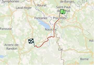

Length
22 km

Max alt
1222 m

Uphill gradient
482 m
Km-Effort
29 km

Min alt
899 m

Downhill gradient
500 m
Boucle
No
Creation date :
2022-04-23 06:33:43.486
Updated on :
2022-04-23 11:46:29.093
5h11
Difficulty : Very difficult

FREE GPS app for hiking
 SityTrail
IGN / Geographical institutes
SityTrail Plus
The world is yours!
About
Trail Walking of 22 km to be discovered at Auvergne-Rhône-Alpes, Haute-Loire, Pradelles. This trail is proposed by bruno38.
Positioning
Country:
France
Region :
Auvergne-Rhône-Alpes
Department/Province :
Haute-Loire
Municipality :
Pradelles
Location:
Unknown
Start:(Dec)
Start:(UTM)
569884 ; 4957850 (31T) N.
Comments