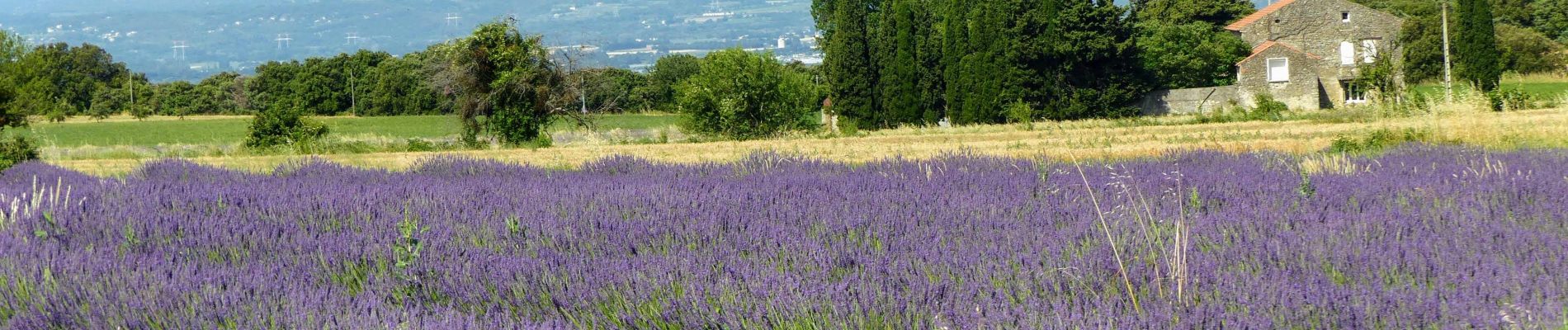
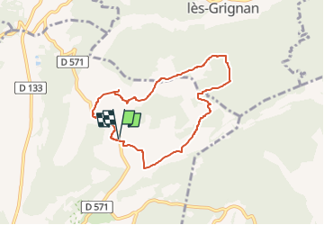
SityTrail - Clansayes Le Rouvergue 6km

thonyc
User GUIDE

Length
7.2 km

Max alt
322 m

Uphill gradient
88 m
Km-Effort
8.4 km

Min alt
254 m

Downhill gradient
88 m
Boucle
Yes
Creation date :
2022-04-23 15:12:50.589
Updated on :
2022-06-06 15:28:13.796
2h00
Difficulty : Easy

FREE GPS app for hiking
 SityTrail
IGN / Geographical institutes
SityTrail Plus
The world is yours!
About
Trail Walking of 7.2 km to be discovered at Auvergne-Rhône-Alpes, Drôme, Clansayes. This trail is proposed by thonyc.
Description
Le Rouvergue
Photos


Positioning
Country:
France
Region :
Auvergne-Rhône-Alpes
Department/Province :
Drôme
Municipality :
Clansayes
Location:
Unknown
Start:(Dec)
Start:(UTM)
644645 ; 4916106 (31T) N.
Comments