


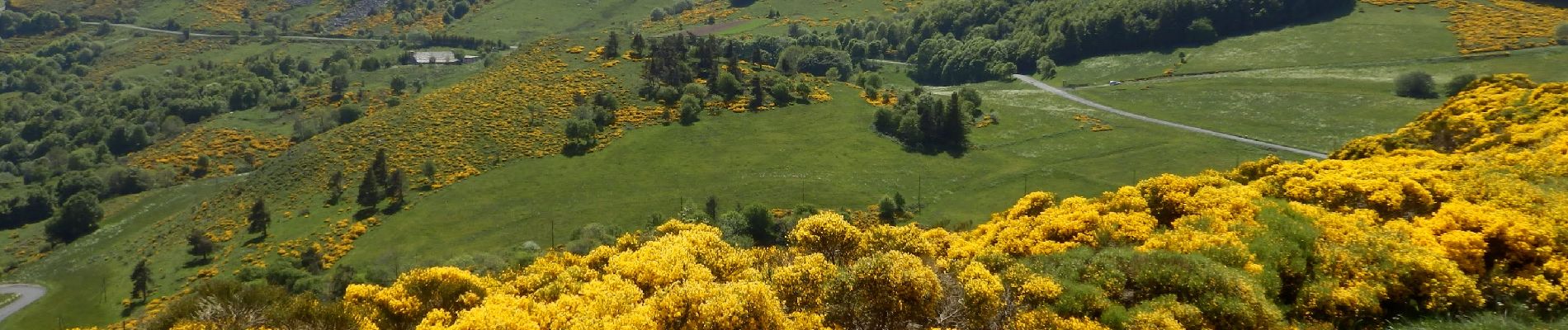
Tour du Mont Mézenc 14,5km

thonyc
User GUIDE
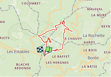

Length
14.5 km

Max alt
1740 m

Uphill gradient
469 m
Km-Effort
21 km

Min alt
1320 m

Downhill gradient
471 m
Boucle
Yes
Creation date :
2022-04-24 10:07:44.56
Updated on :
2022-05-03 08:01:12.519
4h47
Difficulty : Medium

FREE GPS app for hiking
 SityTrail
IGN / Geographical institutes
SityTrail Plus
The world is yours!
About
Trail Walking of 14.5 km to be discovered at Auvergne-Rhône-Alpes, Ardèche, Borée. This trail is proposed by thonyc.
Photos


Positioning
Country:
France
Region :
Auvergne-Rhône-Alpes
Department/Province :
Ardèche
Municipality :
Borée
Location:
Unknown
Start:(Dec)
Start:(UTM)
593580 ; 4972467 (31T) N.
Comments