


calberte St j du gard

bruno38
User

Length
28 km

Max alt
759 m

Uphill gradient
714 m
Km-Effort
40 km

Min alt
194 m

Downhill gradient
1258 m
Boucle
No
Creation date :
2022-04-29 06:46:06.879
Updated on :
2022-04-29 13:53:55.333
6h31
Difficulty : Very difficult

FREE GPS app for hiking
 SityTrail
IGN / Geographical institutes
SityTrail Plus
The world is yours!
About
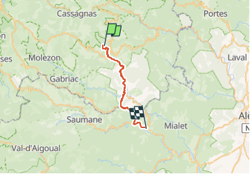
Trail Walking of 28 km to be discovered at Occitania, Lozère, Saint-Germain-de-Calberte. This trail is proposed by bruno38.
Positioning
Country:
France
Region :
Occitania
Department/Province :
Lozère
Municipality :
Saint-Germain-de-Calberte
Location:
Unknown
Start:(Dec)
Start:(UTM)
564002 ; 4897101 (31T) N.
Comments