


Sprimont adeps
© OpenStreetMap contributors


3h35
Difficulty : Medium


Length
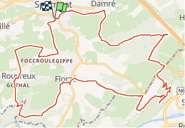
16.5 km
Max alt
312 m
Uphill gradient
417 m
Km-Effort
22 km
Min alt
171 m
Downhill gradient
418 m
Boucle
Yes
Creation date :
2022-04-29 11:23:41.0
Updated on :
2022-04-29 15:13:59.617
3h35
Difficulty : Medium
FREE GPS app for hiking
 SityTrail
IGN / Geographical institutes
SityTrail Plus
The world is yours!
About
Trail Nordic walking of 16.5 km to be discovered at Wallonia, Liège, Sprimont. This trail is proposed by chantal.dgdl@hotmail.com.
Description
Sprimont adeps
Positioning
Country:
Belgium
Region :
Wallonia
Department/Province :
Liège
Municipality :
Sprimont
Location:
Sprimont
Start:(Dec)
Start:(UTM)
688787 ; 5597894 (31U) N.
Comments