


Mayres Chaumiène 12km

thonyc
User GUIDE
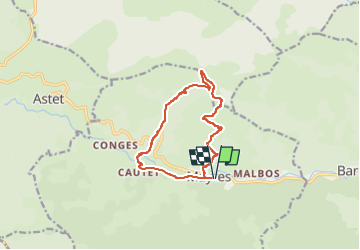

Length
12.2 km

Max alt
1342 m

Uphill gradient
802 m
Km-Effort
23 km

Min alt
572 m

Downhill gradient
801 m
Boucle
Yes
Creation date :
2022-05-01 07:49:43.525
Updated on :
2022-05-02 11:56:32.041
6h43
Difficulty : Difficult

FREE GPS app for hiking
 SityTrail
IGN / Geographical institutes
SityTrail Plus
The world is yours!
About
Trail Walking of 12.2 km to be discovered at Auvergne-Rhône-Alpes, Ardèche, Mayres. This trail is proposed by thonyc.
Description
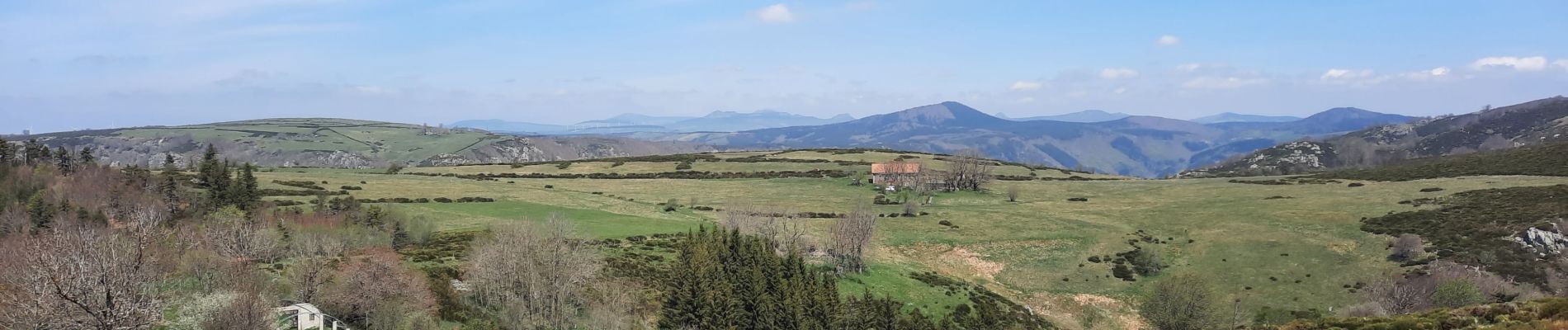
Superbe rando très sportive. Très beaux panoramas.
Forte montée et descente très raide, les bâtons sont donc fort utiles.
Photos


Positioning
Country:
France
Region :
Auvergne-Rhône-Alpes
Department/Province :
Ardèche
Municipality :
Mayres
Location:
Unknown
Start:(Dec)
Start:(UTM)
588479 ; 4946400 (31T) N.
Comments