


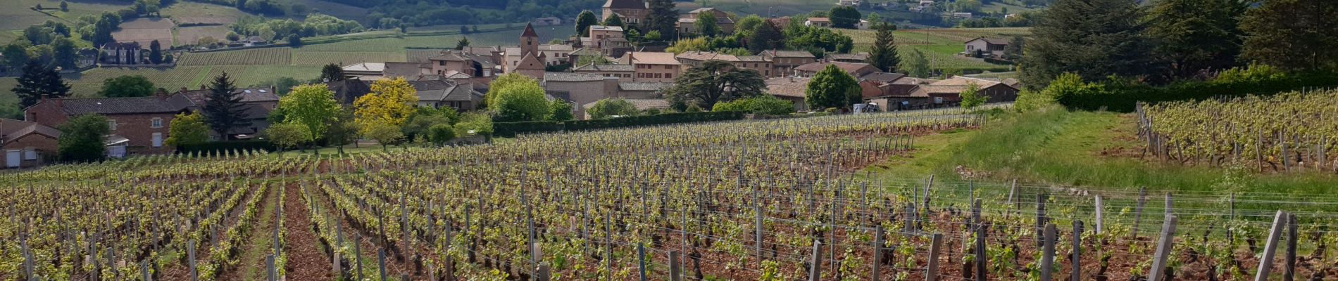
LEYNES 71

janussity
User
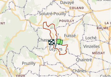

Length
9.5 km

Max alt
478 m

Uphill gradient
242 m
Km-Effort
12.7 km

Min alt
311 m

Downhill gradient
246 m
Boucle
Yes
Creation date :
2022-05-02 12:01:14.249
Updated on :
2022-05-02 15:07:48.881
2h38
Difficulty : Difficult

FREE GPS app for hiking
 SityTrail
IGN / Geographical institutes
SityTrail Plus
The world is yours!
About
Trail Walking of 9.5 km to be discovered at Bourgogne-Franche-Comté, Saône-et-Loire, Leynes. This trail is proposed by janussity.
Description
Beau temps sur le mâconnais.
Facile avec CL
Photos


Positioning
Country:
France
Region :
Bourgogne-Franche-Comté
Department/Province :
Saône-et-Loire
Municipality :
Leynes
Location:
Unknown
Start:(Dec)
Start:(UTM)
633158 ; 5125457 (31T) N.
Comments