


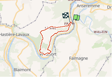
Freyr ADEPSboucle à partir du château.

thomarche
User

Length
10.3 km

Max alt
240 m

Uphill gradient
299 m
Km-Effort
14.2 km

Min alt
95 m

Downhill gradient
297 m
Boucle
No
Creation date :
2022-05-08 12:30:37.0
Updated on :
2022-05-08 15:20:55.724
2h49
Difficulty : Easy

FREE GPS app for hiking
 SityTrail
IGN / Geographical institutes
SityTrail Plus
The world is yours!
About
Trail Walking of 10.3 km to be discovered at Wallonia, Namur, Hastière. This trail is proposed by thomarche.
Description
Très beaux sentiers. Qd même aussi du macadam mais étroit et très peu passant. Sublimes points de vue au-dessus de Waulsort.
Positioning
Country:
Belgium
Region :
Wallonia
Department/Province :
Namur
Municipality :
Hastière
Location:
Unknown
Start:(Dec)
Start:(UTM)
634839 ; 5565283 (31U) N.
Comments