


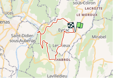
2022-05-13_09h34m16_2022-05-13_767568601_Dolmen de Mias Circuit à partir de Lussas

Linerou
User

Length
14.6 km

Max alt
344 m

Uphill gradient
198 m
Km-Effort
17.3 km

Min alt
261 m

Downhill gradient
198 m
Boucle
Yes
Creation date :
2022-05-13 07:34:16.813
Updated on :
2023-12-31 10:51:38.534
3h55
Difficulty : Difficult

FREE GPS app for hiking
 SityTrail
IGN / Geographical institutes
SityTrail Plus
The world is yours!
About
Trail Walking of 14.6 km to be discovered at Auvergne-Rhône-Alpes, Ardèche, Lussas. This trail is proposed by Linerou.
Positioning
Country:
France
Region :
Auvergne-Rhône-Alpes
Department/Province :
Ardèche
Municipality :
Lussas
Location:
Unknown
Start:(Dec)
Start:(UTM)
616816 ; 4940909 (31T) N.
Comments