


Grand Pot

André Rigollier
User

Length
11.4 km

Max alt
1673 m

Uphill gradient
561 m
Km-Effort
18.9 km

Min alt
1147 m

Downhill gradient
554 m
Boucle
Yes
Creation date :
2022-05-17 07:10:42.669
Updated on :
2022-05-17 14:32:32.982
7h21
Difficulty : Medium

FREE GPS app for hiking
 SityTrail
IGN / Geographical institutes
SityTrail Plus
The world is yours!
About
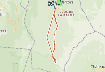
Trail Walking of 11.4 km to be discovered at Auvergne-Rhône-Alpes, Isère, Corrençon-en-Vercors. This trail is proposed by André Rigollier.
Positioning
Country:
France
Region :
Auvergne-Rhône-Alpes
Department/Province :
Isère
Municipality :
Corrençon-en-Vercors
Location:
Unknown
Start:(Dec)
Start:(UTM)
698325 ; 4988702 (31T) N.
Comments