


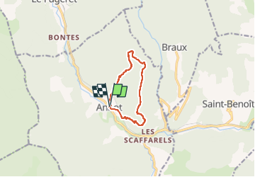
Annot antihoraire

pringel
User

Length
9.3 km

Max alt
1191 m

Uphill gradient
538 m
Km-Effort
16.4 km

Min alt
689 m

Downhill gradient
537 m
Boucle
Yes
Creation date :
2022-05-22 07:25:26.743
Updated on :
2022-05-30 19:17:09.59
3h44
Difficulty : Easy
3h44
Difficulty : Difficult

FREE GPS app for hiking
 SityTrail
IGN / Geographical institutes
SityTrail Plus
The world is yours!
About
Trail On foot of 9.3 km to be discovered at Provence-Alpes-Côte d'Azur, Alpes-de-Haute-Provence, Annot. This trail is proposed by pringel.
Positioning
Country:
France
Region :
Provence-Alpes-Côte d'Azur
Department/Province :
Alpes-de-Haute-Provence
Municipality :
Annot
Location:
Unknown
Start:(Dec)
Start:(UTM)
312911 ; 4870764 (32T) N.
Comments