


gif

janussity
User
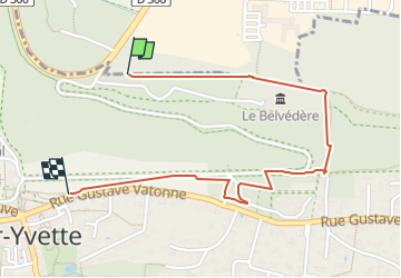

Length
1.8 km

Max alt
169 m

Uphill gradient
9 m
Km-Effort
2.2 km

Min alt
88 m

Downhill gradient
83 m
Boucle
No
Creation date :
2022-05-22 08:23:53.845
Updated on :
2022-05-22 09:18:04.671
37m
Difficulty : Easy

FREE GPS app for hiking
 SityTrail
IGN / Geographical institutes
SityTrail Plus
The world is yours!
About
Trail Walking of 1.8 km to be discovered at Ile-de-France, Essonne, Saint-Aubin. This trail is proposed by janussity.
Positioning
Country:
France
Region :
Ile-de-France
Department/Province :
Essonne
Municipality :
Saint-Aubin
Location:
Unknown
Start:(Dec)
Start:(UTM)
436679 ; 5395133 (31U) N.
Comments