


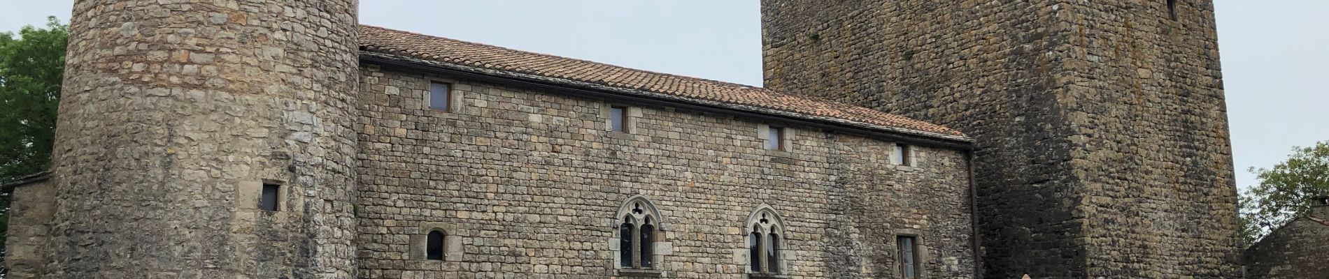
Ste eulalie Viala pas de jaux

Glurps
User
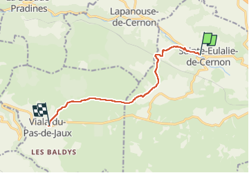

Length
9.1 km

Max alt
824 m

Uphill gradient
315 m
Km-Effort
12.5 km

Min alt
562 m

Downhill gradient
83 m
Boucle
No
Creation date :
2022-05-23 06:27:31.0
Updated on :
2022-05-23 09:35:38.202
2h42
Difficulty : Difficult

FREE GPS app for hiking
 SityTrail
IGN / Geographical institutes
SityTrail Plus
The world is yours!
About
Trail Walking of 9.1 km to be discovered at Occitania, Aveyron, Sainte-Eulalie-de-Cernon. This trail is proposed by Glurps.
Photos


Positioning
Country:
France
Region :
Occitania
Department/Province :
Aveyron
Municipality :
Sainte-Eulalie-de-Cernon
Location:
Unknown
Start:(Dec)
Start:(UTM)
510512 ; 4869933 (31T) N.
Comments