


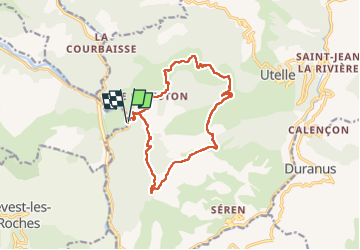
La Madone d'Utelle : boucle partant du Chaudan

franquen
User

Length
16.1 km

Max alt
1178 m

Uphill gradient
1107 m
Km-Effort
31 km

Min alt
179 m

Downhill gradient
1118 m
Boucle
Yes
Creation date :
2022-05-23 07:38:19.291
Updated on :
2022-05-24 05:55:59.065
6h58
Difficulty : Difficult

FREE GPS app for hiking
 SityTrail
IGN / Geographical institutes
SityTrail Plus
The world is yours!
About
Trail Walking of 16.1 km to be discovered at Provence-Alpes-Côte d'Azur, Maritime Alps, Utelle. This trail is proposed by franquen.
Description
Rando assez difficile par sa longueur, le sentier souvent pierrier.
Dernier tronçon en devers et mal tracé.
Rencontre et discussion insolite avec le seul habitant du Reveston.
Positioning
Country:
France
Region :
Provence-Alpes-Côte d'Azur
Department/Province :
Maritime Alps
Municipality :
Utelle
Location:
Unknown
Start:(Dec)
Start:(UTM)
355173 ; 4862929 (32T) N.
Comments