


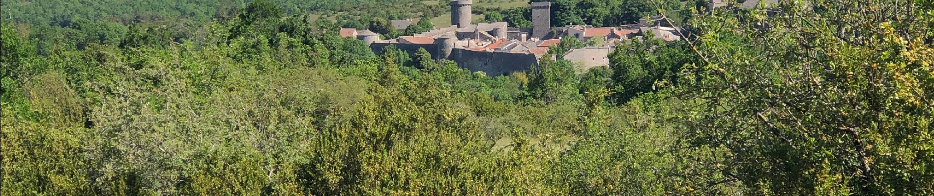
Cornus caumartin

Glurps
User
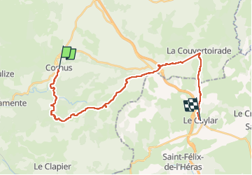

Length
28 km

Max alt
836 m

Uphill gradient
703 m
Km-Effort
37 km

Min alt
525 m

Downhill gradient
592 m
Boucle
No
Creation date :
2022-05-25 06:54:14.0
Updated on :
2022-05-26 10:15:07.999
8h12
Difficulty : Very difficult

FREE GPS app for hiking
 SityTrail
IGN / Geographical institutes
SityTrail Plus
The world is yours!
About
Trail Walking of 28 km to be discovered at Occitania, Aveyron, Cornus. This trail is proposed by Glurps.
Photos


Positioning
Country:
France
Region :
Occitania
Department/Province :
Aveyron
Municipality :
Cornus
Location:
Unknown
Start:(Dec)
Start:(UTM)
514358 ; 4860861 (31T) N.
Comments