


Col de la Ruchère-2022-G3-1-Chartroussette

Valmeinier
User
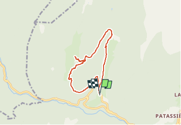

Length
6.7 km

Max alt
1093 m

Uphill gradient
276 m
Km-Effort
10.4 km

Min alt
834 m

Downhill gradient
276 m
Boucle
Yes
Creation date :
2022-05-27 04:30:38.331
Updated on :
2022-05-27 04:30:38.331
2h22
Difficulty : Medium

FREE GPS app for hiking
 SityTrail
IGN / Geographical institutes
SityTrail Plus
The world is yours!
About
Trail Walking of 6.7 km to be discovered at Auvergne-Rhône-Alpes, Isère, Saint-Pierre-de-Chartreuse. This trail is proposed by Valmeinier.
Positioning
Country:
France
Region :
Auvergne-Rhône-Alpes
Department/Province :
Isère
Municipality :
Saint-Pierre-de-Chartreuse
Location:
Unknown
Start:(Dec)
Start:(UTM)
718499 ; 5025739 (31T) N.
Comments