


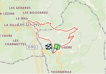


47 km | 82 km-effort


User


FREE GPS app for hiking
 SityTrail
IGN / Geographical institutes
SityTrail World
The world is yours!
Trail Walking of 7.9 km to be discovered at Auvergne-Rhône-Alpes, Savoy, Thoiry. This trail is proposed by phidge.
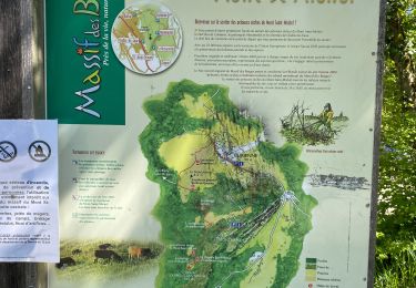
Circuit permettant d'évoluer au-dessus de la Rivière Leysse.
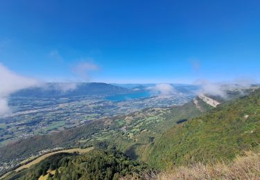
Magnifique vue sur la vallée de Thoiry à la Thuile, vue sur la pointe de la Galoppaz .
Au retour passage, sous l'imposant massif du Magériaz

Running

Walking

Walking

Walking

Snowshoes
Walking

Cycle
Walking
Walking
belle randonnée facile 400 m de dénivelé à peine 10 km parfait pour moi.