


gdl210714

gue
User
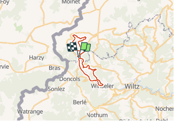

Length
19.9 km

Max alt
492 m

Uphill gradient
500 m
Km-Effort
27 km

Min alt
327 m

Downhill gradient
505 m
Boucle
Yes
Creation date :
2014-12-10 00:00:00.0
Updated on :
2014-12-10 00:00:00.0
3h30
Difficulty : Medium

FREE GPS app for hiking
 SityTrail
IGN / Geographical institutes
SityTrail Plus
The world is yours!
About
Trail Walking of 19.9 km to be discovered at Unknown, Canton Clervaux, Wincrange. This trail is proposed by gue.
Positioning
Country:
Luxembourg
Region :
Unknown
Department/Province :
Canton Clervaux
Municipality :
Wincrange
Location:
Unknown
Start:(Dec)
Start:(UTM)
704727 ; 5541755 (31U) N.
Comments