


Haut de Chavigny

noelphil
User
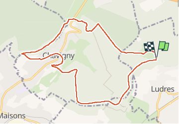

Length
10.7 km

Max alt
421 m

Uphill gradient
199 m
Km-Effort
13.3 km

Min alt
283 m

Downhill gradient
198 m
Boucle
Yes
Creation date :
2022-06-03 11:40:50.527
Updated on :
2022-06-03 14:51:18.331
3h09
Difficulty : Difficult

FREE GPS app for hiking
 SityTrail
IGN / Geographical institutes
SityTrail Plus
The world is yours!
About
Trail Walking of 10.7 km to be discovered at Grand Est, Meurthe-et-Moselle, Ludres. This trail is proposed by noelphil.
Positioning
Country:
France
Region :
Grand Est
Department/Province :
Meurthe-et-Moselle
Municipality :
Ludres
Location:
Unknown
Start:(Dec)
Start:(UTM)
290661 ; 5390099 (32U) N.
Comments