


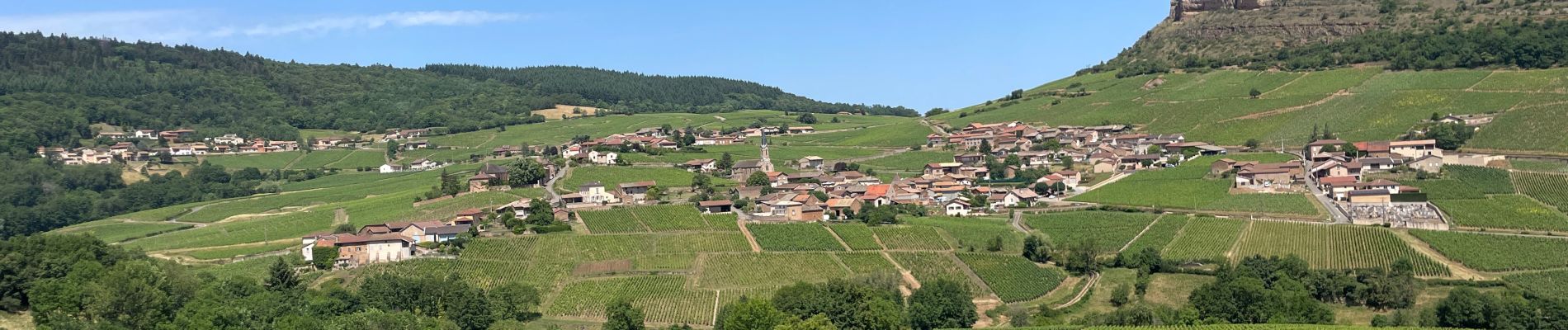
Roche de solutré

yves62410
User
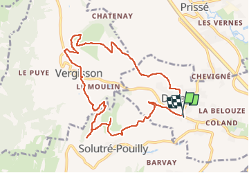

Length
10.5 km

Max alt
476 m

Uphill gradient
451 m
Km-Effort
16.5 km

Min alt
217 m

Downhill gradient
447 m
Boucle
Yes
Creation date :
2022-06-04 08:19:17.0
Updated on :
2022-06-04 12:15:49.311
3h54
Difficulty : Difficult

FREE GPS app for hiking
 SityTrail
IGN / Geographical institutes
SityTrail Plus
The world is yours!
About
Trail Walking of 10.5 km to be discovered at Bourgogne-Franche-Comté, Saône-et-Loire, Davayé. This trail is proposed by yves62410.
Description
Fin a simplifier
Photos


Positioning
Country:
France
Region :
Bourgogne-Franche-Comté
Department/Province :
Saône-et-Loire
Municipality :
Davayé
Location:
Unknown
Start:(Dec)
Start:(UTM)
634133 ; 5129161 (31T) N.
Comments