


Citadelle de Namur bord de Meuse

FMV144
User
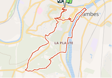

Length
11 km

Max alt
224 m

Uphill gradient
314 m
Km-Effort
15.2 km

Min alt
72 m

Downhill gradient
320 m
Boucle
Yes
Creation date :
2022-06-05 09:41:52.0
Updated on :
2022-06-05 12:15:00.063
2h32
Difficulty : Easy

FREE GPS app for hiking
 SityTrail
IGN / Geographical institutes
SityTrail Plus
The world is yours!
About
Trail Walking of 11 km to be discovered at Wallonia, Namur, Namur. This trail is proposed by FMV144.
Positioning
Country:
Belgium
Region :
Wallonia
Department/Province :
Namur
Municipality :
Namur
Location:
Namur
Start:(Dec)
Start:(UTM)
631908 ; 5591561 (31U) N.
Comments