


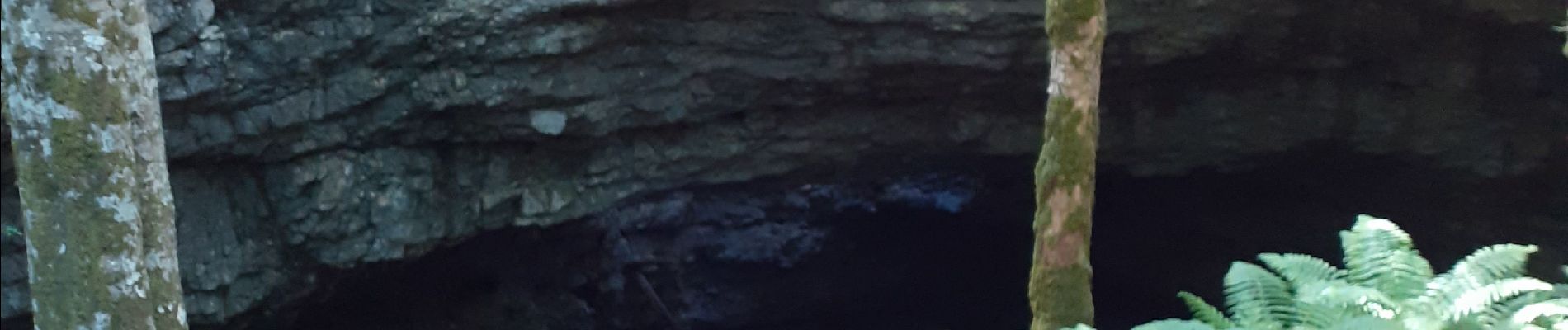
grotte de la cheminée

cousam
User
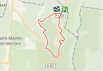

Length
8.4 km

Max alt
1398 m

Uphill gradient
303 m
Km-Effort
12.4 km

Min alt
1214 m

Downhill gradient
303 m
Boucle
Yes
Creation date :
2022-06-06 07:39:49.034
Updated on :
2022-06-07 06:08:58.421
4h34
Difficulty : Medium

FREE GPS app for hiking
 SityTrail
IGN / Geographical institutes
SityTrail Plus
The world is yours!
About
Trail Walking of 8.4 km to be discovered at Auvergne-Rhône-Alpes, Drôme, Saint-Martin-en-Vercors. This trail is proposed by cousam.
Description
Boucle par la grotte de la cheminée (glissant ) prévoir frontale
chemin de la Pia
scialet du Pot du Loup
Gour Fumant
Photos


Positioning
Country:
France
Region :
Auvergne-Rhône-Alpes
Department/Province :
Drôme
Municipality :
Saint-Martin-en-Vercors
Location:
Unknown
Start:(Dec)
Start:(UTM)
694851 ; 4989516 (31T) N.
Comments