


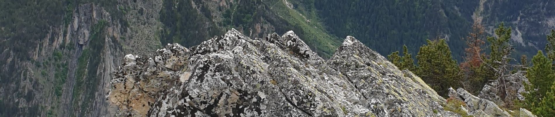
Rocher de Villeneuve

janussity
User

Length
12.8 km

Max alt
2179 m

Uphill gradient
989 m
Km-Effort
26 km

Min alt
1363 m

Downhill gradient
990 m
Boucle
Yes
Creation date :
2022-06-08 06:32:29.542
Updated on :
2022-06-08 13:17:26.181
4h25
Difficulty : Difficult

FREE GPS app for hiking
 SityTrail
IGN / Geographical institutes
SityTrail Plus
The world is yours!
About
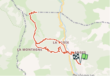
Trail Walking of 12.8 km to be discovered at Auvergne-Rhône-Alpes, Savoy, Pralognan-la-Vanoise. This trail is proposed by janussity.
Description
1000m de dénivelé. temps légèrement pluvieux au retour. CL 12 personnes avec le guide Vincent.
Photos


Positioning
Country:
France
Region :
Auvergne-Rhône-Alpes
Department/Province :
Savoy
Municipality :
Pralognan-la-Vanoise
Location:
Unknown
Start:(Dec)
Start:(UTM)
321455 ; 5028580 (32T) N.
Comments