


Trail SNU

cps46
User

Length
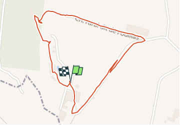
1.4 km

Max alt
196 m

Uphill gradient
56 m
Km-Effort
2.1 km

Min alt
129 m

Downhill gradient
51 m
Boucle
Yes
Creation date :
2022-06-10 07:13:02.0
Updated on :
2022-06-10 07:29:49.16
16m
Difficulty : Unknown

FREE GPS app for hiking
 SityTrail
IGN / Geographical institutes
SityTrail Plus
The world is yours!
About
Trail Trail of 1.4 km to be discovered at Occitania, Tarn-et-Garonne, Lauzerte. This trail is proposed by cps46.
Positioning
Country:
France
Region :
Occitania
Department/Province :
Tarn-et-Garonne
Municipality :
Lauzerte
Location:
Unknown
Start:(Dec)
Start:(UTM)
349315 ; 4901406 (31T) N.
Comments