


Ceyssat,Puy de Dôme

alinetpierre
User
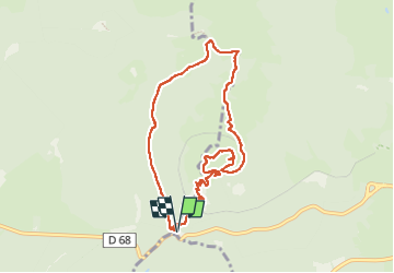

Length
9 km

Max alt
1462 m

Uphill gradient
425 m
Km-Effort
14.7 km

Min alt
1061 m

Downhill gradient
425 m
Boucle
Yes
Creation date :
2022-06-10 08:56:49.138
Updated on :
2022-06-10 15:01:07.694
2h27
Difficulty : Medium

FREE GPS app for hiking
 SityTrail
IGN / Geographical institutes
SityTrail Plus
The world is yours!
About
Trail Walking of 9 km to be discovered at Auvergne-Rhône-Alpes, Puy-de-Dôme, Orcines. This trail is proposed by alinetpierre.
Description
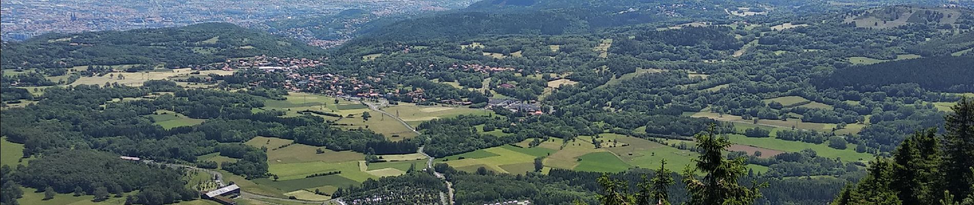
le Puy de Dôme par le GR4 variante
Photos


Positioning
Country:
France
Region :
Auvergne-Rhône-Alpes
Department/Province :
Puy-de-Dôme
Municipality :
Orcines
Location:
Unknown
Start:(Dec)
Start:(UTM)
496610 ; 5067840 (31T) N.
Comments