


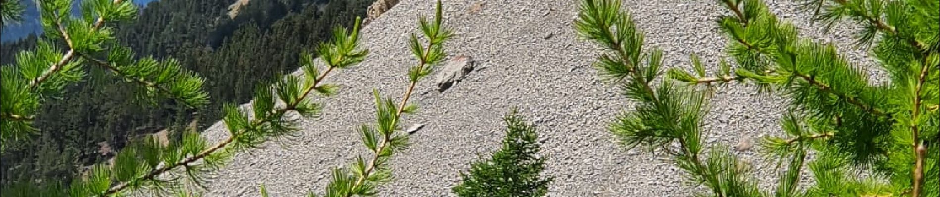
ceillac col fromage

ferosine
User
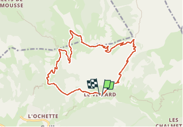

Length
10.1 km

Max alt
2559 m

Uphill gradient
755 m
Km-Effort
20 km

Min alt
1815 m

Downhill gradient
747 m
Boucle
Yes
Creation date :
2022-06-13 06:31:05.434
Updated on :
2022-06-23 15:25:24.037
3h36
Difficulty : Medium

FREE GPS app for hiking
 SityTrail
IGN / Geographical institutes
SityTrail Plus
The world is yours!
About
Trail Walking of 10.1 km to be discovered at Provence-Alpes-Côte d'Azur, Hautes-Alpes, Ceillac. This trail is proposed by ferosine.
Photos

Positioning
Country:
France
Region :
Provence-Alpes-Côte d'Azur
Department/Province :
Hautes-Alpes
Municipality :
Ceillac
Location:
Unknown
Start:(Dec)
Start:(UTM)
325262 ; 4949338 (32T) N.
Comments