


givet olligny en therache

Ahimsa
User
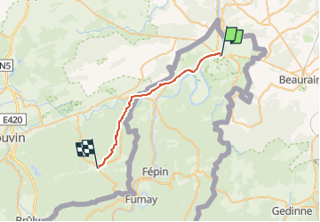

Length
22 km

Max alt
372 m

Uphill gradient
508 m
Km-Effort
28 km

Min alt
97 m

Downhill gradient
306 m
Boucle
No
Creation date :
2022-06-14 06:00:19.882
Updated on :
2022-06-14 06:00:22.667
6h27
Difficulty : Very difficult

FREE GPS app for hiking
 SityTrail
IGN / Geographical institutes
SityTrail Plus
The world is yours!
About
Trail Walking of 22 km to be discovered at Grand Est, Ardennes, Givet. This trail is proposed by Ahimsa.
Positioning
Country:
France
Region :
Grand Est
Department/Province :
Ardennes
Municipality :
Givet
Location:
Unknown
Start:(Dec)
Start:(UTM)
630746 ; 5555138 (31U) N.
Comments