


saint pierre de chartreuse

panetJeanLuc
User
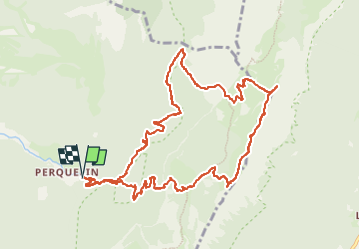

Length
13 km

Max alt
1953 m

Uphill gradient
996 m
Km-Effort
26 km

Min alt
995 m

Downhill gradient
999 m
Boucle
Yes
Creation date :
2022-06-14 06:48:35.352
Updated on :
2022-06-14 20:17:35.008
3h27
Difficulty : Very difficult

FREE GPS app for hiking
 SityTrail
IGN / Geographical institutes
SityTrail Plus
The world is yours!
About
Trail Walking of 13 km to be discovered at Auvergne-Rhône-Alpes, Isère, Saint-Pierre-de-Chartreuse. This trail is proposed by panetJeanLuc.
Positioning
Country:
France
Region :
Auvergne-Rhône-Alpes
Department/Province :
Isère
Municipality :
Saint-Pierre-de-Chartreuse
Location:
Unknown
Start:(Dec)
Start:(UTM)
723122 ; 5023661 (31T) N.
Comments