


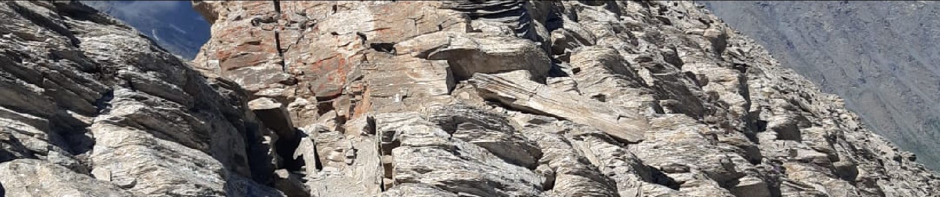
pain de sucre lac foréant

ferosine
User
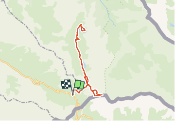

Length
14.9 km

Max alt
3163 m

Uphill gradient
973 m
Km-Effort
28 km

Min alt
2397 m

Downhill gradient
972 m
Boucle
Yes
Creation date :
2022-06-14 06:29:38.305
Updated on :
2022-06-23 15:23:31.87
5h13
Difficulty : Difficult

FREE GPS app for hiking
 SityTrail
IGN / Geographical institutes
SityTrail Plus
The world is yours!
About
Trail Walking of 14.9 km to be discovered at Provence-Alpes-Côte d'Azur, Hautes-Alpes, Molines-en-Queyras. This trail is proposed by ferosine.
Photos

Positioning
Country:
France
Region :
Provence-Alpes-Côte d'Azur
Department/Province :
Hautes-Alpes
Municipality :
Molines-en-Queyras
Location:
Unknown
Start:(Dec)
Start:(UTM)
339613 ; 4950546 (32T) N.
Comments