


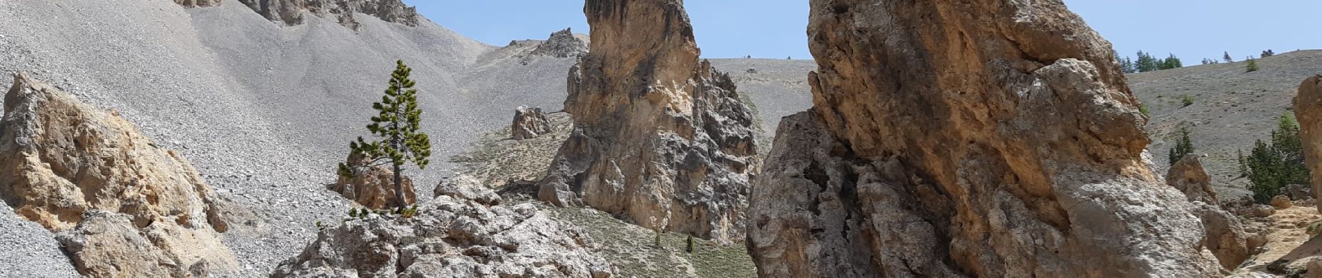
isoard Col des portes

ferosine
User
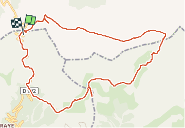

Length
13.5 km

Max alt
2896 m

Uphill gradient
913 m
Km-Effort
26 km

Min alt
2174 m

Downhill gradient
918 m
Boucle
Yes
Creation date :
2022-06-17 06:05:22.094
Updated on :
2022-06-23 15:09:03.656
4h27
Difficulty : Difficult

FREE GPS app for hiking
 SityTrail
IGN / Geographical institutes
SityTrail Plus
The world is yours!
About
Trail Walking of 13.5 km to be discovered at Provence-Alpes-Côte d'Azur, Hautes-Alpes, Cervières. This trail is proposed by ferosine.
Photos

Positioning
Country:
France
Region :
Provence-Alpes-Côte d'Azur
Department/Province :
Hautes-Alpes
Municipality :
Cervières
Location:
Unknown
Start:(Dec)
Start:(UTM)
320915 ; 4965460 (32T) N.
Comments