


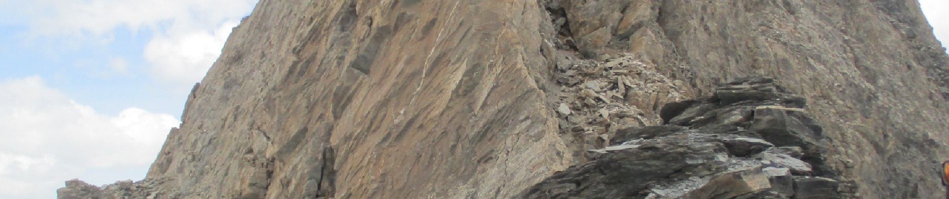
col Agnel Lac et Col d'Asti

ferosine
User
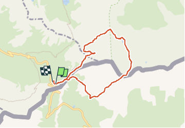

Length
7.3 km

Max alt
3127 m

Uphill gradient
639 m
Km-Effort
15.9 km

Min alt
2668 m

Downhill gradient
657 m
Boucle
Yes
Creation date :
2022-06-18 06:29:19.231
Updated on :
2022-06-23 15:01:09.41
3h12
Difficulty : Difficult

FREE GPS app for hiking
 SityTrail
IGN / Geographical institutes
SityTrail Plus
The world is yours!
About
Trail Walking of 7.3 km to be discovered at Provence-Alpes-Côte d'Azur, Hautes-Alpes, Molines-en-Queyras. This trail is proposed by ferosine.
Description
Indice 110
Photos

Positioning
Country:
France
Region :
Provence-Alpes-Côte d'Azur
Department/Province :
Hautes-Alpes
Municipality :
Molines-en-Queyras
Location:
Unknown
Start:(Dec)
Start:(UTM)
339962 ; 4949969 (32T) N.
Comments