Trail  Pont-Audemer - SityTrail - 2988921 - saint-xgermainxvillage-2021-10-31_ - Photo

SityTrail - 2988921 - saint-xgermainxvillage-2021-10-31_

© OpenStreetMap contributors
Length
Length
19.2 km
Max alt
Max alt
126 m
Uphill gradient
Uphill gradient
409 m
Km-Effort
Km-Effort  
25 km
Min alt
Min alt
13 m
Downhill gradient
Downhill gradient
411 m
Boucle
Boucle
Yes
Creation date :
2022-06-19 18:23:28.571
Updated on :
2022-06-19 18:23:28.571

(0 Reviews)


Scan this QR Code to open this trail in the SityTrail application

FREE GPS app for hiking

Logo SityTrail SityTrail

IGN / Geographical institutes

Download SityTrail from the App Store Download SityTrail from Google Play

Logo SityTrail SityTrail Plus

The world is yours!

Download SityTrail from the App Store Download SityTrail from Google Play Download SityTrail on Huawei AppGallery

About

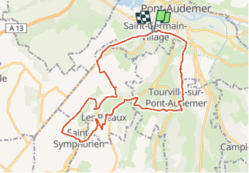
Trail of 19.2 km to be discovered at Normandy, Eure, Pont-Audemer. This trail is proposed by Laurent53.

Description

Randonnée en montagnes russes et variée: nombreux ruisseaux; belles maisons
Chasse possible dans les bois entre septembre et février
Si la randonnée est faite dans le sens anti-horaire, pique-niquer sur le site de la chapelle des Préaux

Elevation profile

Points of interest

Point of interest Les Préaux - pique-nique 30 12 2018 - Photo
Laurent53
Point of interest Tourville-sur-Pont-Audemer - arbre barrant le chemin-passer par le bois - Photo
Laurent53
TOURVILLE-SUR-PONT-AUDEMER 

Positioning

Country:
France
Region :
Normandy
Department/Province :
Eure
Municipality :
Pont-Audemer
Location:
Unknown
Start:(UTM)
318736 ; 5469190 (31U) N.


Close
My subscriptions