


220623-StJean.Vetre- Sapeau-Colombier

randodan
User


2h09
Difficulty : Medium

FREE GPS app for hiking
 SityTrail
IGN / Geographical institutes
SityTrail Plus
The world is yours!
About
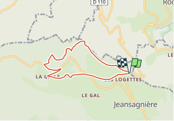
Trail Walking of 6.7 km to be discovered at Auvergne-Rhône-Alpes, Loire, Chalmazel-Jeansagnière. This trail is proposed by randodan.
Description
Préparation utilisée à la place, en guise de tracé, car BIG PB appli/portable (carte tournante, arrêt intempestif enregistrement).
Avons pris raccourci PAS marqué sur IGN !!!!!!!!!!!!!!!!!!!!!!!!!!!
Positioning
Comments