


Bocard d'Eylie / Bentaillou

jcboutin
User
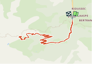

Length
22 km

Max alt
1874 m

Uphill gradient
1074 m
Km-Effort
36 km

Min alt
927 m

Downhill gradient
1073 m
Boucle
Yes
Creation date :
2022-05-26 06:21:18.328
Updated on :
2022-06-26 12:58:59.368
6h50
Difficulty : Difficult

FREE GPS app for hiking
 SityTrail
IGN / Geographical institutes
SityTrail Plus
The world is yours!
About
Trail Walking of 22 km to be discovered at Occitania, Ariège, Sentein. This trail is proposed by jcboutin.
Description
Randonnée vers le site minier
Positioning
Country:
France
Region :
Occitania
Department/Province :
Ariège
Municipality :
Sentein
Location:
Unknown
Start:(Dec)
Start:(UTM)
331458 ; 4744523 (31T) N.
Comments