


roquebrune

any1950
User
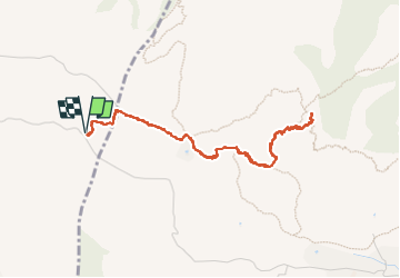

Length
4.6 km

Max alt
320 m

Uphill gradient
198 m
Km-Effort
7.2 km

Min alt
172 m

Downhill gradient
198 m
Boucle
Yes
Creation date :
2022-06-27 07:38:31.63
Updated on :
2022-06-27 10:40:39.617
3h00
Difficulty : Medium

FREE GPS app for hiking
 SityTrail
IGN / Geographical institutes
SityTrail Plus
The world is yours!
About
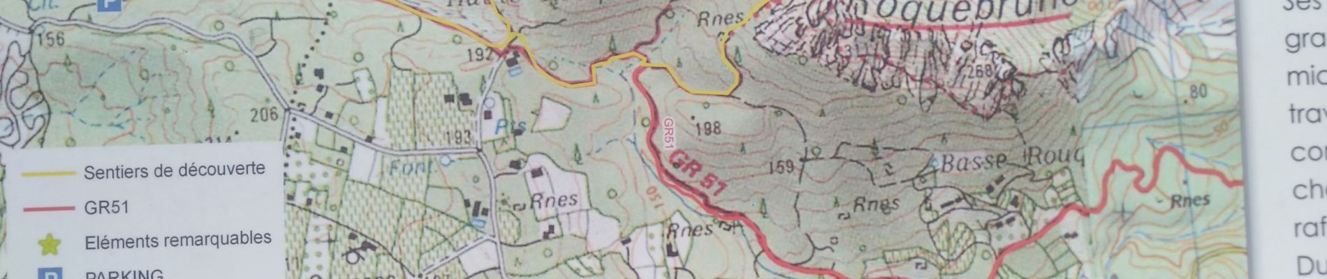
Trail Walking of 4.6 km to be discovered at Provence-Alpes-Côte d'Azur, Var, Le Muy. This trail is proposed by any1950.
Description
super
Photos


Positioning
Country:
France
Region :
Provence-Alpes-Côte d'Azur
Department/Province :
Var
Municipality :
Le Muy
Location:
Unknown
Start:(Dec)
Start:(UTM)
304707 ; 4813420 (32T) N.
Comments