


les gardioles hautes alpes

labarone
User
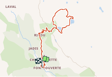

Length
11 km

Max alt
2552 m

Uphill gradient
688 m
Km-Effort
20 km

Min alt
1862 m

Downhill gradient
692 m
Boucle
Yes
Creation date :
2022-06-27 07:41:50.862
Updated on :
2022-06-27 14:38:29.064
5h02
Difficulty : Medium

FREE GPS app for hiking
 SityTrail
IGN / Geographical institutes
SityTrail Plus
The world is yours!
About
Trail Walking of 11 km to be discovered at Provence-Alpes-Côte d'Azur, Hautes-Alpes, Névache. This trail is proposed by labarone.
Description
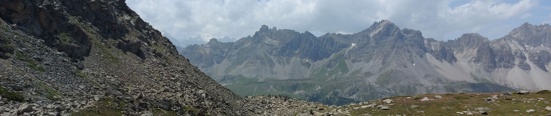
super belles vues bien sûr
belles fleurs et une marmotte
Photos


Positioning
Country:
France
Region :
Provence-Alpes-Côte d'Azur
Department/Province :
Hautes-Alpes
Municipality :
Névache
Location:
Unknown
Start:(Dec)
Start:(UTM)
306660 ; 4989682 (32T) N.
Comments