


BALBOUNE (Limousis)

CANON2
User
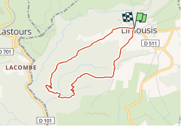

Length
4 km

Max alt
370 m

Uphill gradient
142 m
Km-Effort
5.9 km

Min alt
227 m

Downhill gradient
141 m
Boucle
Yes
Creation date :
2022-06-29 08:47:05.219
Updated on :
2022-06-29 08:47:34.22
1h20
Difficulty : Easy

FREE GPS app for hiking
 SityTrail
IGN / Geographical institutes
SityTrail Plus
The world is yours!
About
Trail Walking of 4 km to be discovered at Occitania, Aude, Limousis. This trail is proposed by CANON2.
Positioning
Country:
France
Region :
Occitania
Department/Province :
Aude
Municipality :
Limousis
Location:
Unknown
Start:(Dec)
Start:(UTM)
451458 ; 4798113 (31T) N.
Comments