


Pont d'Espagne & Lac de Gaube

MarcLEBARON
User
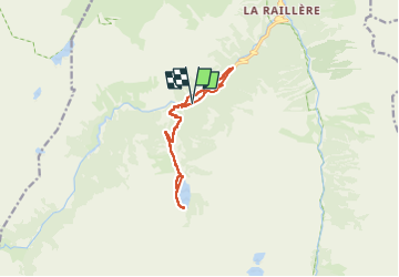

Length
12.8 km

Max alt
1777 m

Uphill gradient
482 m
Km-Effort
19.2 km

Min alt
1365 m

Downhill gradient
482 m
Boucle
Yes
Creation date :
2022-06-30 07:31:15.998
Updated on :
2022-12-03 01:14:09.827
3h42
Difficulty : Medium

FREE GPS app for hiking
 SityTrail
IGN / Geographical institutes
SityTrail Plus
The world is yours!
About
Trail Walking of 12.8 km to be discovered at Occitania, Hautespyrenees, Cauterets. This trail is proposed by MarcLEBARON.
Description
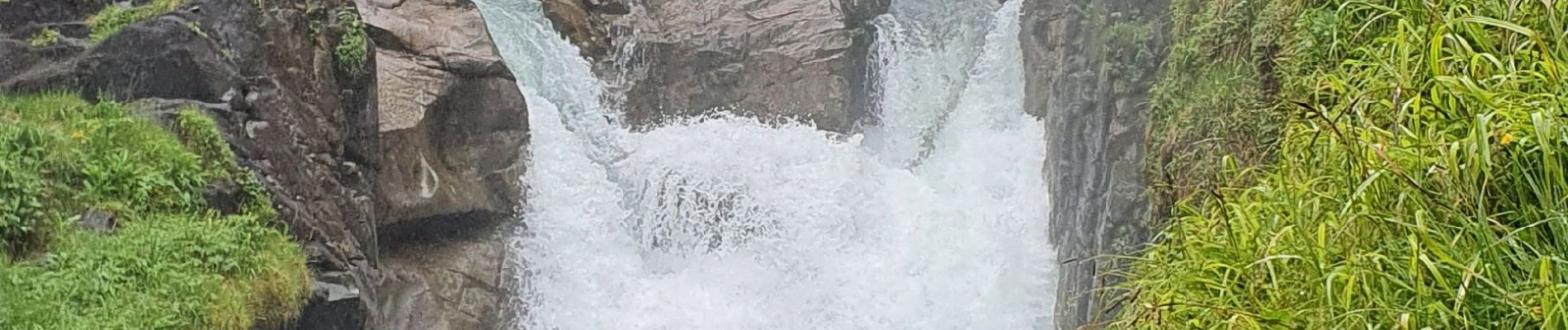
Que d'eau.... retour par la rive gauche
Photos


Positioning
Country:
France
Region :
Occitania
Department/Province :
Hautespyrenees
Municipality :
Cauterets
Location:
Unknown
Start:(Dec)
Start:(UTM)
733940 ; 4748325 (30T) N.
Comments