


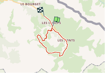
Arsem Les fonts de Cervieres

labarone
User

Length
13.4 km

Max alt
2603 m

Uphill gradient
698 m
Km-Effort
23 km

Min alt
1931 m

Downhill gradient
734 m
Boucle
No
Creation date :
2022-06-30 08:06:46.061
Updated on :
2022-06-30 15:13:43.517
5h44
Difficulty : Medium

FREE GPS app for hiking
 SityTrail
IGN / Geographical institutes
SityTrail Plus
The world is yours!
About
Trail Walking of 13.4 km to be discovered at Provence-Alpes-Côte d'Azur, Hautes-Alpes, Cervières. This trail is proposed by labarone.
Description
agréable
pleins de fleurs
avec guide Anne
Photos


Positioning
Country:
France
Region :
Provence-Alpes-Côte d'Azur
Department/Province :
Hautes-Alpes
Municipality :
Cervières
Location:
Unknown
Start:(Dec)
Start:(UTM)
326210 ; 4969362 (32T) N.
Comments