


Brevent - aiguilles des Houches

jeanmarcMasson
User GUIDE
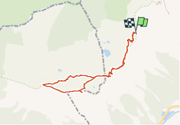

Length
9.1 km

Max alt
2507 m

Uphill gradient
571 m
Km-Effort
16.7 km

Min alt
2119 m

Downhill gradient
565 m
Boucle
Yes
Creation date :
2022-07-01 07:38:37.805
Updated on :
2022-07-03 07:10:02.336
4h03
Difficulty : Very difficult

FREE GPS app for hiking
 SityTrail
IGN / Geographical institutes
SityTrail Plus
The world is yours!
About
Trail Walking of 9.1 km to be discovered at Auvergne-Rhône-Alpes, Upper Savoy, Chamonix-Mont-Blanc. This trail is proposed by jeanmarcMasson.
Positioning
Country:
France
Region :
Auvergne-Rhône-Alpes
Department/Province :
Upper Savoy
Municipality :
Chamonix-Mont-Blanc
Location:
Unknown
Start:(Dec)
Start:(UTM)
332357 ; 5088945 (32T) N.
Comments